10 TOP ATTRACTIONS IN BAHARIYA
Al-Wahat al-Bahriyah, 'the northern oasis', lies in a great depression about 360 km southwest of Cairo. In the past, when people from Bahariya wanted to go to the Nile Valley, they often waited for a caravan to pass, They traveled in three days between the Nile and the oasis.It is completely surrounded by high steep slopes. In the Cretaceous Period (145 to 65 million years ago), volcanic episodes formed the basalt columns that dominate the oasis. At 128 meters above sea level, the oasis has the highest point of all western desert oases.It covers an area of nearly 1,800 km²; at the longest point it is 94 kilometers and at the widest 42 kilometers. Once the oasis was the bottom of an immense ocean. Although Bahariya has been inhabited for at least 10,000 years, strangely enough, no human traces have been found that predated the Middle Kingdom of Ancient Egypt (2055-1770 BC). The oldest grave found dates from the 18th Dynasty (1550-1292 BC) and its owner is Amenhotep Huy. Especially from the 26th Dynasty until the Roman era, Bahariya flourished culturally and economically. This can be learned from the chapels in Ain el-Muftilla, the tombs in Qãrat Qasr Selim and Qãrat al-Subi. Today, the oasis (36,000 inhabitants) is made up of several small villages (Managim, el-Hara, Mandisha, Zabw, Agouz, Bawiti, and al-Haiz), each surrounded by palms and fruit trees.
Bawiti is the main village of the oasis. The road was not paved until 1978 and before that few tourists visited the oasis. Still, although the closest to Cairo in kilometers, the oasis remains the farthest from time.
It is slow to go to the modern world, a facet that is changing, but so far Bahariya offers the visitor a step back in time. It has numerous ancient sites to illustrate its importance in ancient times and is the gateway to the various deserts such as the Black Desert, Aqabat,
Crystal Mountains, Western Desert, the Djara stalactite cave and the white chalk rock sculptures of the White Desert.
1-THE WHITE DESERT
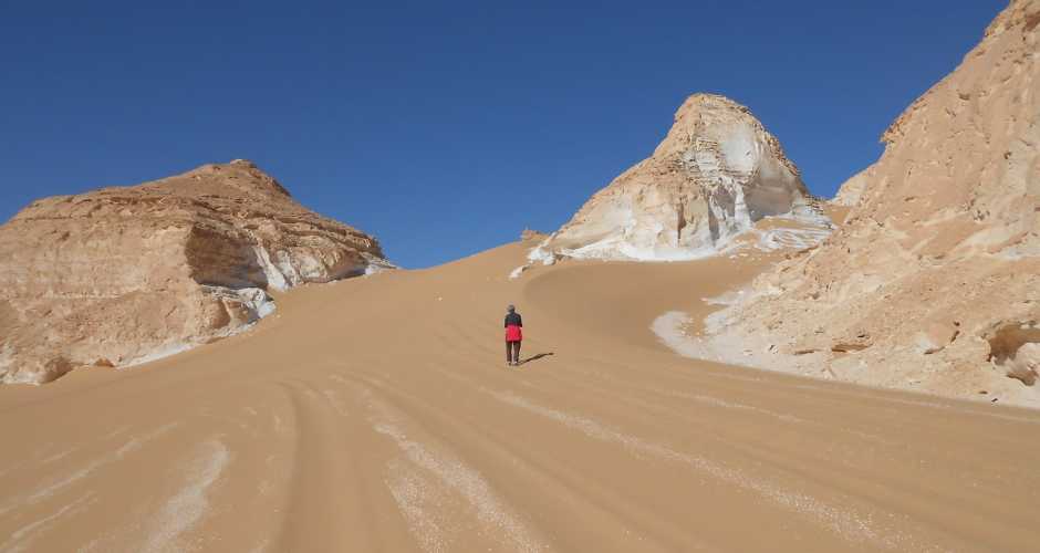
Most visitors to Bahariya Oasis go there to see the White Desert, el-Sahara el-Beida, the area to the north-east of Qasr el-Farafra which is renowned for its spectacular scenery. The chalk-white landscape is strewn with alien shapes, boulders of brilliant white which thrust up from the surface of the desert, intensified by the clear light of noon, shimmering gold at sunset or blackened and shrunken in a cloud-filled sky. Many of the formations are given descriptive names – sculpted by the harsh desert winds into weird shapes that constantly change over time. There are ‘monoliths’ and ‘mushrooms’, ‘ice cream cones’, ‘tents’ and ‘crickets’, as well as the majestic conical flat-topped ‘inselbergs’,o name but a few of the formations. In the remote past, the White Desert was a seabed, the sedimentary layers of rock formed by marine fauna when the ocean dried up. Later a habitat for many roaming herds of elephants, giraffes, gazelle, and other animals, the desert would have been a savannah with lush green areas and lakes full of fish, an ideal hunting ground for pre-historic man. The landscape we see today was formed by the plateau breaking down, leaving harder rock shapes standing while the softer parts are eroded away by wind and sand. In some parts, the chalk surface still has the appearance of delicate wind-ruffled waves on water natural wonder of Egypt, the White Desert is now a protectorate, known as the White Desert Park, where designated routes must be followed when driving in 4WD vehicles.

2- SAHARA SUDA -BLACK DESERT
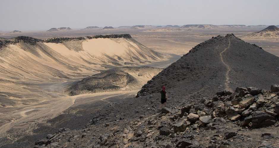
Now all the mountains are spread out for you in an almost straight line along the horizon. We are approaching Sahara Suda, the Black Desert, a favorite safari destination for local tour groups. The ground to the right and left of the road is covered with black stones. Weaving in and out of these mountains is great fun. Although a skilled 2-wheel driver can manage most of it, there is a good chance the car will eventually get stuck. Take a guide—they are not expensive and can tell you things you will never discover by yourself.
3-THE CRYSTAL MOUNTAIN
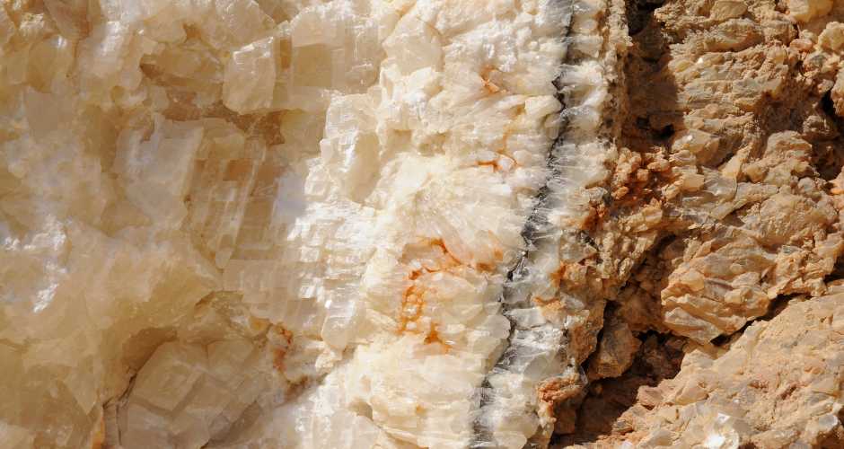
The Crystal Mountain is between the oasis Bahariya and Farafra, northern of the White Desert, Egypt. The Crystals are probably Barite (Schwerspat, BaSO4) and/or Calcite crystals (CaCO3). The hill was opened during works at the road from Farafra to Bahariya by accident and destroyed in part.
4-THE MUSEUM OF THE GOLDEN MUMMIES
several years ago, A donkey fell into a hole and unearthed a spectacular Mummy with a gilded Coffin, kept under wraps as excavation continued, the find was announced to the world as the valley of Golden Mummies. It is believed that this site may contain as many as 10,000 intact from the Roman Period

5-GEBEL MAGHRAFA
Gebel Maghrafa, Mountain of the Ladle, and Dist (they are 50 meters apart) dominate the plain around Bir Ghaba. Maghrafa, the smaller of the two mountains, is an Oligocene ferruginous butte, 600 meters (1920 feet) round at the base and 15 meters (48 feet) at the top. Paralititan stromeri (Stromer's Tidal Giant) is the name of the dinosaur that was rediscovered recently by a Penn/Egyptian Geological Museum team. It is named not only for its location along the shores of an ancient sea, but for its size, being the largest and heaviest dinosaur known, and for the man who first found dinosaurs in Bahariya, the German scientist Ernst Strome, Stromer found the giant creature in 1914 at the base of Gebel Dist.
His research and samples were lost during World War II when his Munich museum was destroyed by Allied bombing. The modern scientists found five tons of material including 16 bones of the giant, some in fragments, but one arm bone 169 centimeters long. They estimate the beast to have been about 25 meters high and to weigh 50 to 80 tons. It ate plants and enjoyed life along coastal lowlands amid mangrove trees about 93-99 million years ago in the Cenomanian stage of the Late Cretaceous period. No other dinosaur has b4n found enjoying mangroves. The dinosaur is not the only find in the area. Fish, turtles, a crocodile and a lot of vegetation tell as that the surroundings were subtropical. Simply retrace your steps back to the place where the desert and garden routes meet and turn right along the garden route. As one continues along the road the entire plain comes into view on the right. With the mountain as the backdrop, there are fields, desert, and long vistas. A good place for photos.
Lake al-Marun
Local legend says that no one should go to Bir al-Marun alone because the afrit (mischievous spirits) hold parties at night, and sometimes the beating of their drums can be heard in the other villages. In fact, there is probably an old Islamic village in this area or at least a caravan stop from the days of the Hagg.
7-BANNENTIU AND DJED-ANKH-AMUN-IUF (ZED-AMUN)
The tombs at Qasr Selim (26th Dynasty) In 1938 the Egyptian archaeologist Ahmed Fakhry (1905-1973) discovered four tombs at the ridge of Qarat Qasr Selim. Two of the tombs are richly decorated and open to the public. The two tombs belong to Zed-Amun-ef-ankh and his son Bannentiu, members of a rich family of merchants. They lived during Ahmose II's (570 - 526 BC) reign. The entrance of the hypostyle burial chamber of Zed-Amun-ef-ankh lies at the bottom of a pit five meters deep. It contains scenes of the funeral procession and the Four Sons of Horus. According to the ancient inscriptions Bannentiu had served as both a priest and prophet. The burial chambers of this tomb can be reached through a shaft about 6 meters deep. The scenes in the inner burial chamber contain a well-preserved representation of the Judgement Hall of Osiris and the weighing of the heart of the deceased. Regrettably, both tombs were reused as burial places during Roman times and robbed in recent times, when some mummies, beads, and amulets were taken. Luckily, both tombs still portray some grand decorations and are useful to our understanding of early life in this Oasis.

6-BAWITI AND QASR
Qasr was the ancient capital of the oasis.Bawiti lies directly over the more ancient settlement and great antiquities are buried beneath its formations, Most of the Ancient Ruins date back to 26th Dynasty

8- GEBEL AL INGLEEZ( THE ENGLISH ENGLISH MOUNTAIN )
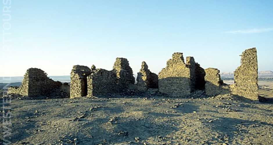
Black or English Mountain This mountain is distinguished by a ruin at its summit. It is not difficult to climb the mountain and the view from the top offers a panorama of the northern part of the oasis. At one corner of the summit are the ruins of a World War I lookout post, which was manned by Captain Williams, after whom the mountain is sometimes called. Williams was posted to Bahariya to observe troop movements by the Sanusi. The house, consisting of three rooms and a bath, is now in ruins. This is the same Captain Claud Williams of the Light Car Patrols for whom Williams Pass along the border of Libya and Egypt.
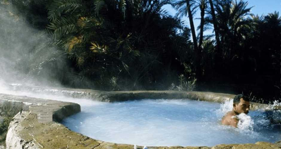
9 -BIR SIGAM HOT SPRING
Soak in the heat at Bir Sigam, a hot spring that can help overcome rheumatism. Located at 7 km east of Bahariya on the Cairo road, the spring is the best hot spring in temperature and Locations
10- VALLEY OF AGABAT( WADI AGABAT)
Valley of Agabat is deep within the white desert. You have to be there to feel the out-worldly beauty of the place. Millions of years ago, the place used to be under the sea. Over the years, unique rock formations of limestone, chalk (and maybe sand) developed. When you stand atop the small rock cliff at one of the valleys and the valley with the rock formation unfolds before you, and there is not a single trace of another living being in the whole vicinity - you'll find a unique moment of peace and contentment. Don't miss it
